Having explored both the Nile and Lake Chad Basins, this blog has focused on the hydro-political conflicts on an international scale. While many of these case studies feature heavily in the news and in academic discourses, it is pertinent that we do not ignore the local scale hydro-politic dynamics. The Sudd Wetland provides a perfect example of regional-scale conflicts over water resources, and how managing smaller scale wetlands like these can in turn alleviate water scarcity issues at a broader scale.
---
The Sudd Wetlands: An introduction
While wetlands are a common feature in all the Nile Basin countries, the Sudd is unique in that it is one of the most valuable and unique ecosystems on the planet. It is located in South Sudan, formed by the White Nile's Bahr al-Jabal section. Its width varies from 10 to 40km and spans over 650km long (Rebelo and McCartney, 2012). The Sudd is also the largest freshwater wetland in the Nile Basin, which stretches over 30,000km squared, with the lateral extent of seasonal flooding being highly variable, and depending on the seasonal conditions (Rebelo and McCartney, 2012). The wetland is so valuable that is a designated Ramsar site that houses endangered mammalian species, rich fish populations, and directly affects the livelihoods of over 1 million people (COEBS, 2021).
View of the Sudd wetlands from the ISS, Jan 2021
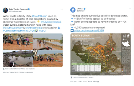
Roughly 80% of the population in Sudan find their livelihoods in agriculture and accounts for about 40% of the country's GDP (Sullivan, 2010). 70% of agriculture in Sudan is rain-fed, and the rest is managed through traditional spate irrigation, khors, hand-dug canals, or via large-scale irrigation projects such as the Gezira project (Sullivan, 2010). Although Sudan has the largest-scale irrigation projects and methods, it is most certainly not the most efficient by any means. Water is life for Sudan. It has access to huge underground water reserves which stem from the Nubian Sandstone Aquifer System (Quadri, 2017). The full extent of the Sudd wetland is extremely variable, ranging from 42,000 km squared in the dry season to 90,000 km squared in the rainy season (COEBS, 2021). However, with the effects of climate change, the region has seen massive and unprecedented levels of flooding which has been detrimental to the people living in the wetlands. These floods have also led to livestock losses which have sparked new conflicts.
Rising tensions: The Jonglei Canal
During the 1970s, Egypt and Sudan began to construct the Jonglei Canal in order to increase the amount of water available within the already hotly contested Nile Basin, however this sparked fierce opposition, with potential sparks of violent conflict due to many local inhabitants fearing that they may lose access to opportunities provided by the wetlands (Ide, 2020). It was started in the mid-1950s but was soon halted in 1984 after significant civil conflict from the Sudan People's Liberation Army (SPLA). It was supposed to divert water from the Bahr al Jabal above the Sudd to bypass the Sudd swamp, and carry white Nile waters directly to the main channel of the river. At least that was the plan. However, with the recent developments of the Nile crisis between Egypt, Ethiopia and Sudan have reached a stalemate, and renewed interest has been shown by Egypt and Sudan in resuming the Jonglei Canal project as a means of providing an alternative water source in response to reduced flows from the GERD project.
Next week's post will look to dive into how this project falls short, and provide some remedies to build towards more sustainable management of water resources in the Sudd Wetland - and beyond this the Nile River Basin.


Comments
Post a Comment